More Deb Stenzel Photos
The descriptions are all by Deb Stenzel:
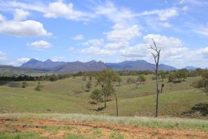
 This photo attached shows Mt Barney (two peaks on the left) and the MacPherson range. The highest area towards the right is Mt Ballow.
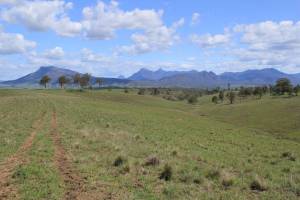
 This photo is from the “Range” that was the boundary between the old Coochin Coochin and Maroon pastoral runs. Mt Maroon on the left, Mt Lindesay (often called “The wedding cake” due to its shape …), then the two peaks of Mt Barney, then the many mountains around Mt Ballow.
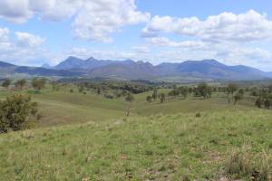
 This photo is from a slightly higher point on the “Range” - for orientation, Maroon homestead would have been almost in the middle of the photo, but down on the creek that is hidden behind the ridges in this photo.
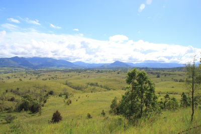
 This photo was taken from the road from Milford/Cannon Creek to Maroon. There are some high ridges along that road, with spectacular views. … It shows a large part of the western end of the original Maroon run. It is looking towards the west - MacPherson range to the south (left of photo), and the Great Dividing range to the west (middle and to the right, in this photo). The original Maroon included all of the land in the foreground (that later became known as Adam's Creek, after my [great-grandfather] Adam Bartholomai selected it), to the range south, and west as far as the biggest conical mountain (Mt Toowoonan) that is just to the left of the green leafy trees near the road in the photo. Beyond Mt Toowoonan, to the Great Dividing Range was part of the original Coochin Coochin. Maroon Dam, constructed in the early 1970s, is in the valley just to the left of Mt Toowoonan. Maroon homestead was located in the valley in the distance, about mid way down the left side of the photo. That's the Burnett Creek. Today, there are lots of cultivated areas along the creek and a couple of dairy farms. The highest mountains of the Great Dividing range are beneath the clouds in this photo - but Cunningham's Gap is just past the extreme right of the photo. I will say that this photo was taken in summer (2021/22), after a we had a lot of rain.